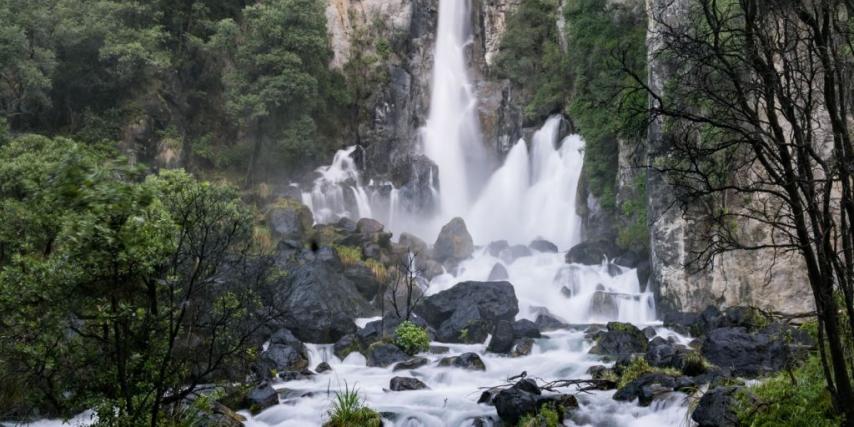
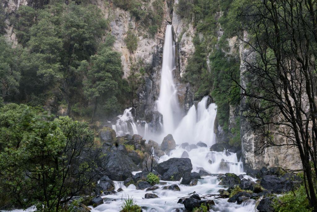
Tarawera Falls
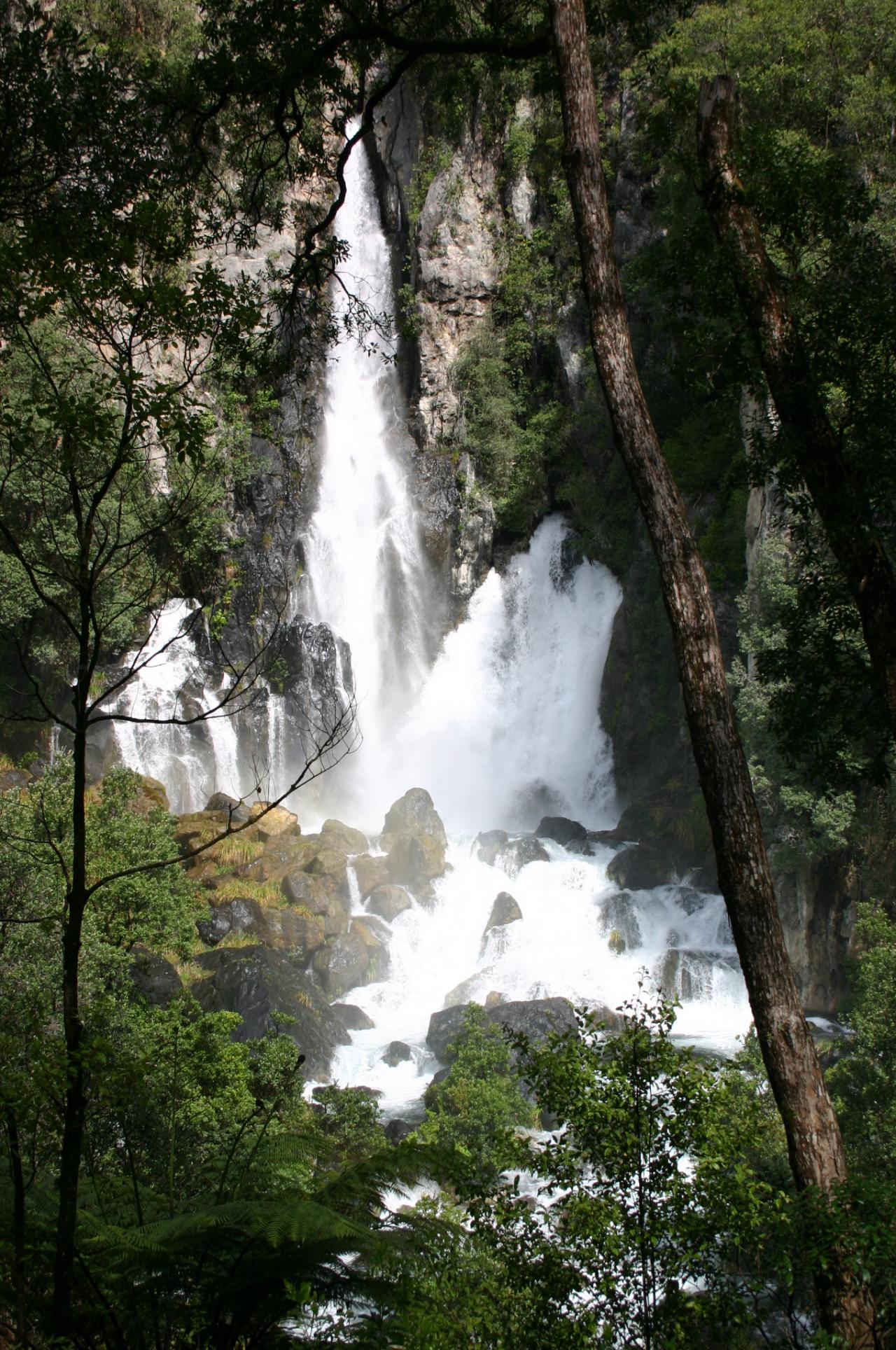
The spectaular Tarawera Falls is a 35-metre high waterfall on the Tarawera River that flows out of Lake Tarawera and across a lava flow that erupted from Mt Tarawera about 11,000 years ago.
The river disappears about 30 metres back from the clifftop into flooded caves in the lava and pours out halfway up the cliff on the far side of the flow. After rain, part of the flow passes over the top of the cliff as a 65-metre tall companion fall.
Access is from the town of Kawerau and is a drive of about 45 minutes over unsealed roads, followed by a walk of about 20 minutes.
A forestry access permit is required, available from the Information Centre in Kawerau.
Note: Caution is advised for those wishing to swim in the river beside the track above the falls, due to underwater currents and the nature of the river.
For more information visit the Department of Conservation or Kawerau i-SITE websites.
Explore Tarawera Falls with Google Street View
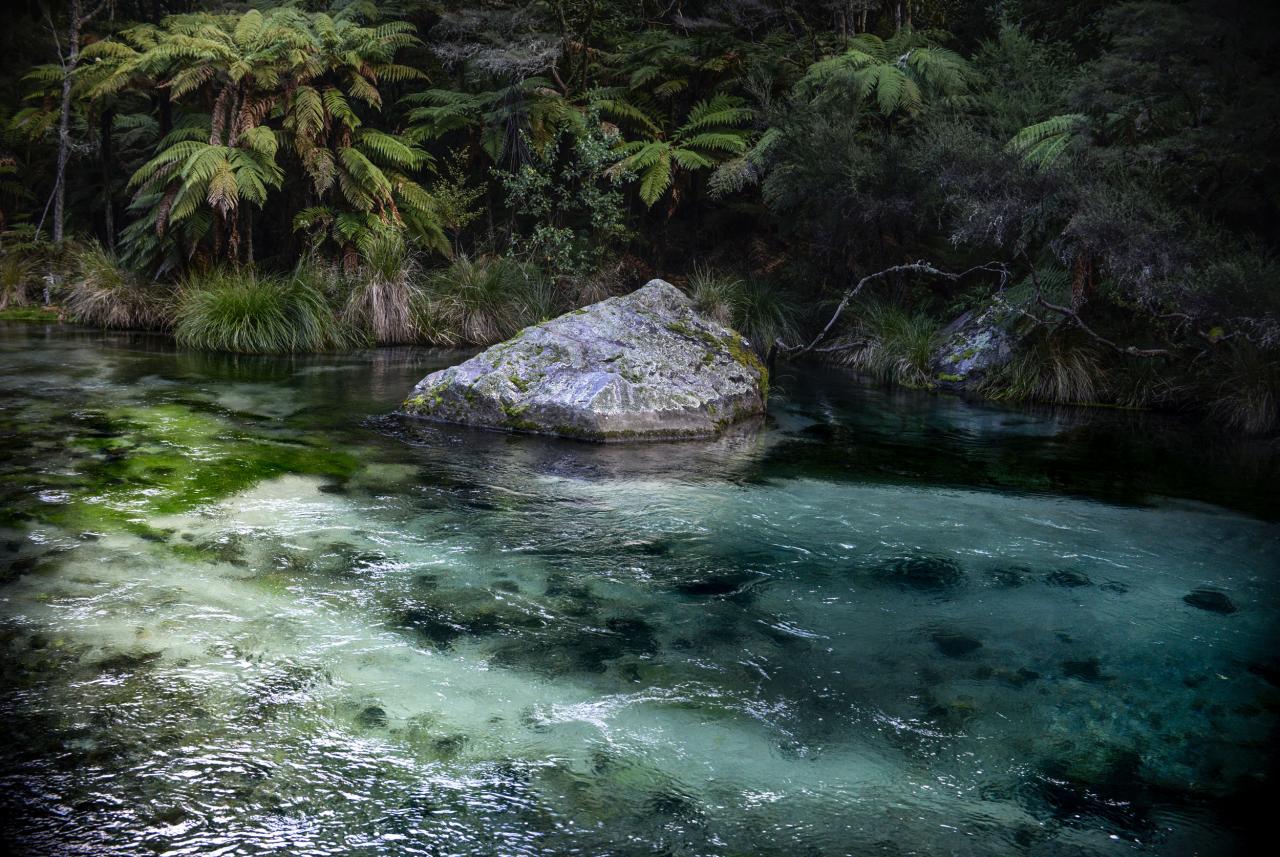
Track to view falls
Contact Details
Tarawera Falls
whakatane3121
New Zealand